ZIP Code 5: 02830 - HARRISVILLE, RI
ZIP Code 02830 is the postal code in HARRISVILLE, RI. Besides the basic information, it also lists the full ZIP code and the address of ZIP code 02830. Whatsmore, there is more information related to ZIP Code 02830. For example, nearby ZIP code around ZIP Code 02830, etc.
ZIP 02830 Basic Information

The basic information of ZIP Code 02830 is as follows, including: country, county, city, FIPS and etc.
| State | County | City | ZIP Code 5 |
|---|---|---|---|
| RI - Rhode Island | Providence County | HARRISVILLE | 02830 |
What is the plus 4 zip code for 02830 ZIP Code? Below is the detail.
02830 ZIP+4 Code List

What are the 4 digit zip extensions of ZIP Code 02830? ZIP code 02830 has many plus 4 codes, and each plus 4 code corresponds to one or more addresses. Below we list all the ZIP+4 codes and their addresses in the ZIP Code 02830. You can find a 9-digit ZIP Code by a full address.
| ZIP Code 5 Plus 4 | Address |
|---|---|
| 02830-0001 | PO BOX 1 (From 1 To 111), HARRISVILLE, RI |
| 02830-0121 | PO BOX 121 (From 121 To 231), HARRISVILLE, RI |
| 02830-0241 | PO BOX 241 (From 241 To 351), HARRISVILLE, RI |
| 02830-0361 | PO BOX 361 (From 361 To 471), HARRISVILLE, RI |
| 02830-0481 | PO BOX 481 (From 481 To 651), HARRISVILLE, RI |
| 02830-1000 | 101 (From 101 To 199 Odd) UNION AVE, HARRISVILLE, RI |
| 02830-1001 | 1 (From 1 To 209 Odd) EMERSON RD, HARRISVILLE, RI |
| 02830-1002 | 2 (From 2 To 60 Even) EMERSON RD, HARRISVILLE, RI |
| 02830-1003 | 1 (From 1 To 99 Odd) HILL RD, HARRISVILLE, RI |
| 02830-1004 | 2 (From 2 To 98 Even) HILL RD, HARRISVILLE, RI |
- Page 1
- ››
Post Office in ZIP Code 02830

HARRISVILLE is the only post office in ZIP Code 02830. You can find the address, phone number, and interactive map below. Click to view the service and service hours about HARRISVILLE.
-
HARRISVILLE Post Office

Address 131 HARRISVILLE MAIN ST, HARRISVILLE, RI, 02830-9998
Phone 401-567-9278
*Street Parking Available
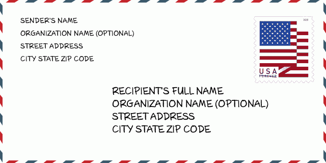
How to write a U.S. envelope?

-
First, you need to fill in the recipient's mailing information in the center of the envelope. The first line is the recipient's name, the second line is the street address with a detailed house number, and the last line is the city, state abbr, and ZIP Code.
Second, write the sender's information on the left top corner of the envelope. If your mail cannot be delivered, it will return to the sender's address.
Finally, don't forget to stick the stamp on the right top corner. Otherwise, the letter will not go into the delivery process.
Here is the envelope example below.
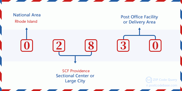
What does each digit of ZIP Code 02830 stand for?
-
The first digit designates a national area, which ranges from zero for the Northeast to nine for the far West.
The 2-3 digits represent a sectional center facility in that region.
The last two digits designate small post offices or postal zones.
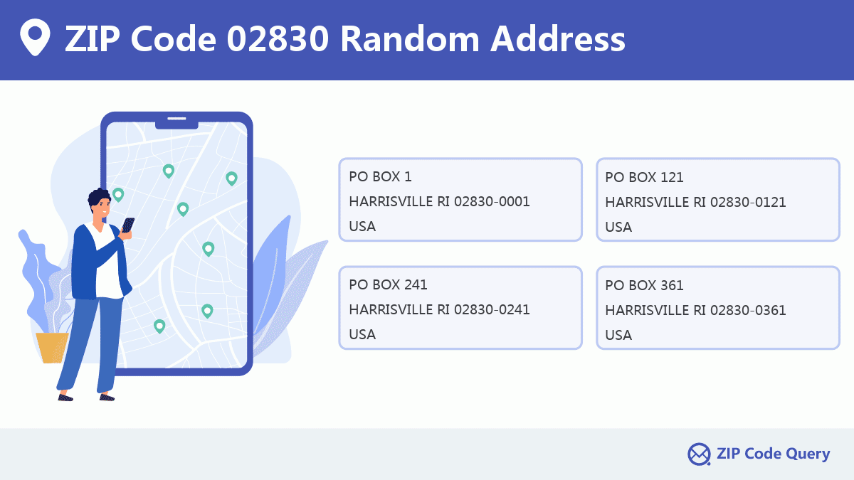
Random Address in ZIP 02830

ZIP Code 02830 has 784 real random addresses, you can clicking the picture below to get random addresses in ZIP Code 02830.
ZIP 02830 Online Map

This is online map of the address HARRISVILLE, Providence County, Rhode Island. You may use button to move and zoom in / out. The map information is for reference only.
ZIP 02830 NearBy ZIP Code
The Nearby ZIP Codes are 02858, 02826, 02839, 02824, and 02876, you can find ZIP codes in a 25km radius around ZIP Code 02830 and the approximate distance between the two ZIP codes.
The data has a slight deviation for your reference only.
| ZIP Code | Distance (Kilo Meters) |
|---|---|
| 02858 | 1.043 |
| 02826 | 1.252 |
| 02839 | 3.51 |
| 02824 | 5.291 |
| 02876 | 6.175 |
| 02859 | 6.198 |
| 02814 | 8.174 |
| 02896 | 8.478 |
| 01529 | 9.459 |
| 01569 | 10.047 |
| 02829 | 10.314 |
| 01504 | 12.217 |
| 02917 | 12.449 |
| 02895 | 12.621 |
| 01516 | 12.752 |
| 02828 | 12.786 |
| 01538 | 12.863 |
| 01525 | 13.913 |
| 02838 | 14.608 |
| 01526 | 15.952 |
| 02802 | 16.093 |
| 02857 | 16.592 |
| 01756 | 16.927 |
| 01588 | 17.126 |
| 06277 | 17.689 |
| 02864 | 17.795 |
| 02865 | 17.931 |
| 01534 | 18.249 |
| 02019 | 18.556 |
| 01570 | 19.156 |
| 02919 | 19.332 |
| 06243 | 19.503 |
| 01747 | 19.538 |
| 02911 | 19.626 |
| 06260 | 19.756 |
| 01590 | 20.252 |
| 06246 | 20.527 |
| 02825 | 20.651 |
| 06233 | 20.711 |
| 06255 | 21.09 |
| 02070 | 21.59 |
| 02904 | 21.781 |
| 06241 | 22.337 |
| 02815 | 22.505 |
| 01757 | 22.569 |
| 02918 | 22.661 |
| 01560 | 22.697 |
| 02908 | 22.768 |
| 02863 | 22.863 |
| 01568 | 22.966 |
| 02909 | 23.491 |
| 02038 | 23.578 |
| 02860 | 23.579 |
| 01540 | 23.825 |
| 02862 | 24.247 |
| 02093 | 24.619 |
| 06245 | 24.697 |

Library in ZIP Code 02830

-
JESSE M. SMITH MEMORIAL LIBRARY
Phone: (401) 710-7800Address: 100 TINKHAM LANE, BURRILLVILLE RI 02830, USA
School in ZIP Code 02830

This is the ZIP Code 02830 - School page list. Its detail School Name, Address, City, State, ZIP Code is as below.
| School Name | Address | City | State | Grades | ZIP Code |
|---|---|---|---|---|---|
| Austin T. Levy School | 135 Harrisville Main Street | Harrisville | Rhode Island | PK-1 | 02830 |
| Burrillville High School | 425 East Avenue | Harrisville | Rhode Island | 9-12 | 02830 |
| Burrillville Middle School | 2220 Broncos Highway | Harrisville | Rhode Island | 6-8 | 02830 |
| William Callahan School | 75 Callahan School Street | Harrisville | Rhode Island | 2-5 | 02830 |
Comment


Add new comment